Why buy from us?
Here are some reasons to choose us.
Ask a Question About This Product
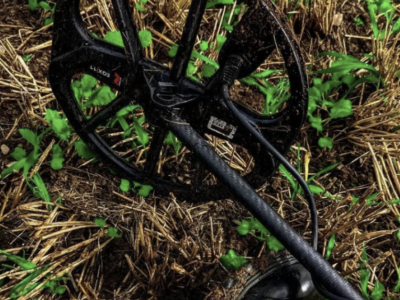
- Stock: In Stock
- Model: GR4
Groundtech GR4 Yer Altı Görüntüleme Cihazı Gradyometre – A New Dimension in Exploration
In treasure hunting, archaeological research, and engineering projects, ground imaging technologies are becoming increasingly important. The next-generation Groundtech GR4 Ground Imaging Device Gradiometer delivers high accuracy and reliable analysis in the field with its advanced 3D ground scanning system and dual-sensor gradiometer technology.
From gold prospecting to cavity detection, this model offers a wide range of applications and is available with professional support through altınordu'da ordu dedektör
What is the Groundtech GR4 Ground Imaging Device Gradiometer?
The Groundtech GR4 Ground Imaging Device Gradiometer is a professional gradiometer-based 3D ground imaging system capable of detecting:
-
Buried metal objects
-
Magnetic field variations
-
Cavities such as rooms, graves, and tunnels
-
Archaeological remains
With its MFS-2 Dual Sensor Technology (Gradiometer) ±2000 µT capacity, it precisely detects magnetic differences and presents detailed data for analysis.
Advanced 3D Ground Imaging Technology
The Groundtech GR4 Ground Imaging Device Gradiometer operates with three different scanning modes:
-
3D Ground Scan
-
Live Scan
-
Pinpointer
These modes allow users to view ground imaging data instantly on the device’s built-in color display. Thanks to its 240 MHz CPU and 12-bit A/D converter, collected data is processed quickly and accurately.
The 3D scanning system provides scanning capability up to 15 meters depth (according to manufacturer data).
Standalone Operation & Portable Design
The Groundtech GR4 Ground Imaging Device Gradiometer works independently without the need for a smartphone or tablet. All settings and analyses can be managed directly from the integrated screen.
With its foldable modular body structure and adjustable grip angle, it offers:
-
Easy transportation
-
Fast setup
-
Ergonomic use during long operations
It ensures maximum practicality in fieldwork.
Advanced 3D / 4D Analysis with G-PORTAL Mobile Application
The device connects wirelessly via Bluetooth 4.2 BLE to the G-Portal Android & iOS application.
This enables:
-
3D and 4D analysis
-
Advanced reporting
-
Data storage
-
Detailed office-based review
It combines fast field scanning with in-depth office analysis capabilities.
Difference Between GR-4 and GR-4 Dual
The standard Groundtech GR4 Ground Imaging Device Gradiometer model does not include a built-in metal detector system.
The GR-4 Dual model integrates Pulse Induction (PI) metal detector technology.
GR-4 Dual Features
-
1 kHz Pulse Induction technology
-
Superior performance in highly mineralized soils
-
Stable operation on salty ground and coastal areas
-
Detection depth up to 3 meters (manufacturer data)
Thanks to its modular design, the PI search coil can be attached easily, converting the system into a dual-function device. This eliminates the need to carry two separate devices, offering both 3D ground imaging and professional PI metal detection in one system.
Technical Specifications
GR-4
-
System: 3D Ground Scanner
-
Sensor: MFS-2 Dual Sensor Technology (Gradiometer) ±2000 µT
-
CPU: 240 MHz – 12-bit A/D converter
-
Depth: Up to 15 meters (3D scanning)
-
Battery: 3.7V Li-ion rechargeable
-
Operating Time: Approx. 10 hours
-
Charging: Type-C 25W
-
Language Support: Device 11 languages, Mobile app 25 languages
-
Warranty: 2 years
GR-4 Dual
-
System: 3D Ground Scanner + Pulse Induction Detector
-
Detector Depth: Up to 3 meters (manufacturer data)
-
PI Operating Time: Approx. 6 hours
-
3D Scanning Time: Approx. 10 hours
-
Other specifications identical to GR-4
Operating Temperature: 0°C – 70°C
Storage Conditions: -20°C – 60°C
Ground Imaging Prices & Performance
Considering ground imaging prices, the Groundtech GR4 Ground Imaging Device Gradiometer stands out with its competitive positioning and advanced technology.
For professional users, it offers:
-
High sensitivity
-
Deep scanning capability
-
Portability
-
Mobile analysis support
These advantages provide long-term efficiency and strong price-performance value.
Professional Support in Altınordu
The Groundtech GR4 Ground Imaging Device Gradiometer is available with professional support and technical service through altınordu'da ordu dedektör
Regional service, after-sales support, and technical consultation ensure maximum efficiency and reliability.
Conclusion: A Powerful Ground Imaging Solution
The Groundtech GR4 Ground Imaging Device Gradiometer offers:
✔ Advanced gradiometer technology
✔ 3D ground scanning system
✔ Up to 15 meters depth capability
✔ Mobile 3D / 4D analysis support
✔ Foldable modular design
It is a powerful and flexible ground imaging solution for treasure hunters, archaeologists, and engineers alike.
Note: The technical specifications listed above are based on manufacturer-provided data.